It is well known, particularly, one might say, in our part of the south coast, that our relationship with France has not always been cordial. Matters improved during the 19th century of course, culminating in the Entente Cordiale of 1904, partly engineered by the passionately Francophile King Edward VII. Indeed, his last illness began during a stay at Biarritz in March 1910. After attending a performance in a very warm theatre, he was kept waiting for his car outside in the cold. Bronchitis developed, preventing his return to England, where he had a part to play in trying to prevent a political crisis. Because his illness was not reported in the British press, His Majesty was criticised for staying away, supposedly enjoying himself in France.
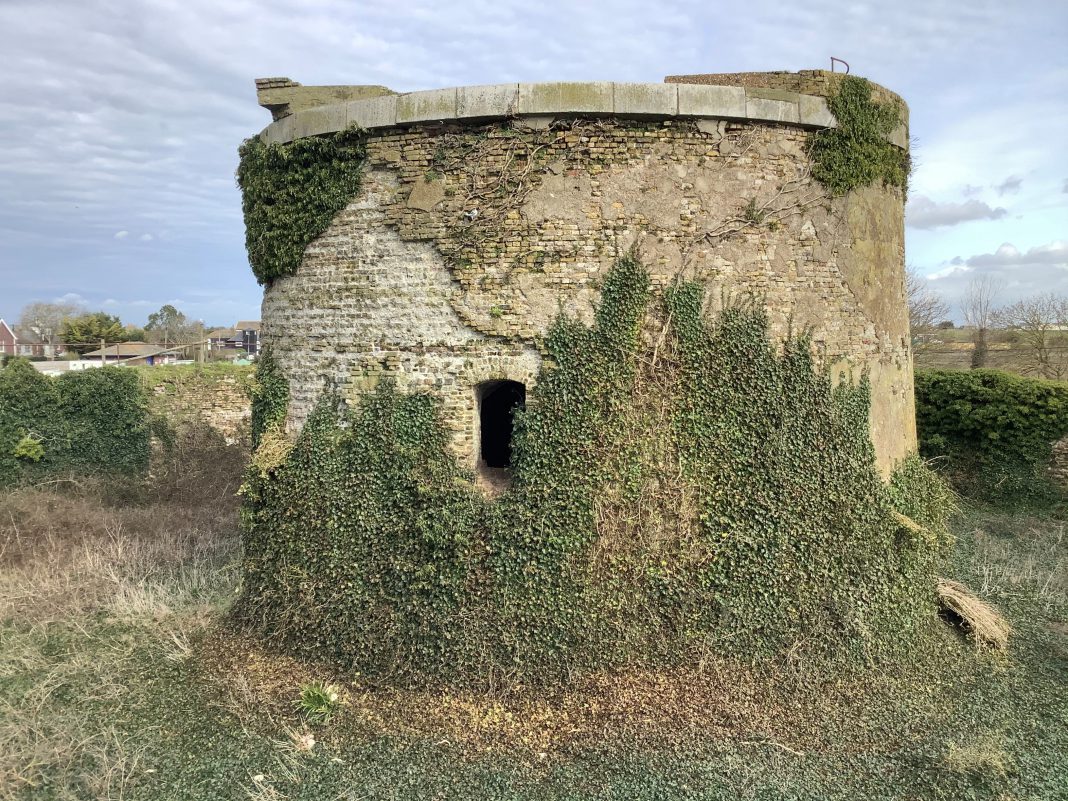
Between Rye and Sandgate, we can still see concrete evidence of that poor relationship. There were some 18 Martello towers, in effect circular gun towers. Some of them were in rather remote areas, hard to keep stocked and garrisoned. Built at huge expense, to counter an invasion by Napoleon that never happened, they are now gone, ruined or put to a number of non-military uses. Indeed, one had been abandoned by 1809 because of erosion. By 1822 it had collapsed.
To service the towers, a canal was dug between 1804 – 1806, known as the Royal Military Canal. Stretching for just under 30 miles, the main section runs from Hythe to Iden. A further section runs from Cliff End near Hastings to the base of Winchelsea Hill, joined to the main branch by the rivers Brede and Rother. Its original width was 60 feet, with a depth of nine feet. On the side nearest the sea was a towpath and drain. On the land side was a parapet, another drain and the Royal Military Road.
Unlike most civilian canals, which tried to run as straight a route as possible, the Royal Military Canal was built with a bend every third of a mile. This was to allow for raised gun emplacements with 18 pound cannon, and to ensure a wide ground of fire.
Civilian barges were allowed to navigate the canal, on payment of a toll. When the threat of invasion had passed, later in the 19th century, the canal was sold off in sections. The whole length was taken over by the military during the first and second world wars, with gun emplacements more or less where they had been originally sited.
Contemporary with the canal is the Royal Military Road. This has a humble beginning as just a towpath by the canal at Cliff End. Things change to the east of Winchelsea, where the route is now the main road, the A259, which continues on to Rye. The original route then becomes separate from the modern road, which avoids the centre of the town, going instead around it.
Cross over the railway near Landgate Square, and on the right is Military Road, which is the original route again. Outside Rye, and before Appledore, there are great views of the canal. The road crosses the canal just outside Appledore, then runs parallel to it for a short distance. It becomes a very popular footpath leading from Hamstreet and on all the way to Hythe. At last, in Hythe, it joins the A261 until it meets the A259. Between there and Sandgate Esplanade it is once more a footpath, to the end of the canal. All in all, some interesting history to be seen and enjoyed.
Image Credits: Nick Forman .


