

Rye may need to accommodate up to 325 new homes by 2042 but there’s some concern that services and infrastructure will need upgrading to cope with almost 2,000 more residents in the town and surrounding district.
The additional housing for Rye, designated as “site allocations” in Rother District Council’s Draft Rother Local Plan 2025-2042, are slated for six locations identified by the Rye Neighbourhood Plan (RNP) and two smaller sites. However, one expert points out that this duplication is contrary to “planning guidance” and that district council site allocations should not replicate RNP site advice as it leads to uncertainty over who controls the size of the site.
When surrounding settlements are taken into account, a total of 791 new homes could be built in this part of eastern Rother within the next 16 years (see list below).
Rye Town Council’s Neighbourhood Plan Coordinator, Dr Anthony Kimber, believes Rye can “live with” the 325 extra homes figure in Rye but anything more would be unachievable because of the serious constraints, such as flood risk and protected biodiversity.
More homes and greater density
In a bid to comply with government policy that some have dubbed “build, build, build”, RDC could be seen to have conceded to developers’ demands by allocating greater housing numbers — meaning that certain housing sites could see very high residential density per hectare (dph).
For example, the Ferry Road site in Rye — controversially designated “urban” — is now provisionally allocated for 88 homes, giving it a residential density of more than 130 dph, akin to parts of London. The Freda Gardham site has now been allocated for 50 homes and sources suggest a further six could be sought.
In effect, densities are being linked to site area definitions. If higher densities are ultimately agreed, those areas designated “urban” in Rye, Battle and Bexhill might see 120-150 dph. This would have significant impacts on services, infrastructure, sewerage, drainage, car parking and so forth.
But Dr Kimber says, “The category ‘urban’ does not realistically apply to Rye”, and he asserts that a density of 40 dph (the ‘Live Well Locally’ category) is more appropriate for the developments expected here.
“Suburban” areas could see 60-75 dph, urban edges 40 dph, and villages 35-40 dph. The latter figure might comprise those villages with development boundaries, but the options remain unclear. New housing in those villages or hamlets without development boundaries may possibly have to “reflect the existing character of the area” and there could be other constraints, although it seems these locations are witnessing 35-40 dph sites allocated to them.
Earlier this week, a meeting of Rye Town Council’s Planning and Townscape Committee was told some of RDC’s designations of sites as “urban” or “suburban” were being applied inconsistently, leading to higher housing densities in inappropriate locations.
A new RDC proposal is for a village cluster “spatial development option”, in which groups of connected villages centre on hubs such as Rye and Battle.
There may be some public concern expressed about the Draft Rother Local Plan’s proposals on “strategic gaps”, as RDC appears to have left the door open to the option of development in some circumstances. For several crucial reasons, however, Rye Town Council has made known its exceptionally strong support for the strategic gap between Rye and Rye Harbour, as emphasised in the RNP. This vital gap also sits in a high-risk flood zone, as do certain other development sites in Rye.
Some of the Draft Local Plan language regarding development boundaries is also convoluted, RTC was advised.
Rye Town Council has long placed high priority on more affordable housing in Rye and Dr Kimber suggests the Local Plan should give it more emphasis. This type of housing is vitally important for people who work in essential services, for medical and care workers, teachers and for hospitality employees, for example. Many of these people working in Rye are forced to live many miles away owing to elevated home prices.
Given the high number of second homes in Rye and district, some experts argue the Rother Local Plan needs to include a far greater focus on this issue — and solid proposals — because of the way second homes distort housing need.
Of course, an important question is how the eastern Rother area copes with greater demands on doctors, dentists, hospitals, early years education, sewerage, water and other infrastructure, when there’s already evidence that services and systems are under pressure.
Rye Harbour and the villages
Rye Harbour’s industrial estate is set to grow apace, with the zone holding, or set to hold, a huge part of the 20,481 sqm of floorspace across the Rye and Eastern Settlements cluster. Nevertheless, there will be some restrictions on the types of business accepted — with an emphasis on offices, R&D premises, “clean” industrial processes, general industrial, storage and distribution.
Much of Rye’s future employment growth is set to focus on Rye Harbour industrial zone and the area will need infrastructure development to match.
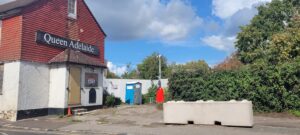
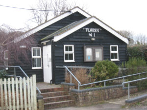
Meanwhile, Playden Parish Council has decided to object to two RDC site allocations for housing estates — one (site PL1) opposite the WI hall in Houghton Green Lane and the other (PL2) at the top of New England Lane.
Both sites could prove controversial. In the case of PL1, it’s understood that Playden WI will not relinquish its car park in a field opposite its hall until the lease expires in late 2029, which could block construction access to a 25-home housing estate. The PL2 site is adjacent to the ‘Shellfield’ property which saw an epic four-year planning battle from 2017-21, in which RDC rejected two planning applications and the Planning Inspectorate refused two appeals.
Icklesham Parish Council will object to a pair of housing estate allocations to the west of the village for a total of 58 houses. One site is on the south side of the village where development has always been rejected by locals, whereas the other site has access road and soakaway issues, the council said.
“Both developments would be overdevelopment in terms of density and local infrastructure, ie, drainage. Both sites are outside the development boundary and could open the floodgates to further development outside of the development boundary,” IPC said.
In other news, the review of the Rye Neighbourhood Plan has been “held in abeyance” since November and it’s unclear when progress will be made, as RDC has yet to provide guidance on target housing numbers and plan period.
Any new development in Rye would generate developers’ contributions in the form of the Community Infrastructure Levy. This would help fund improvements to Rye’s infrastructure, such as improved bus shelters in the Station Approach.
Local residents can lodge comments on the Draft Local Plan 2025-2042 here.
RDC’s proposed new housing allocations for Rye and the Eastern Settlements Cluster
Rye: 325
Peasmarsh: 143
Broad Oak/Brede: 119
Beckley and Four Oaks: 53
Rye Harbour: 40
Playden: 39
Northiam: 32
Iden: 25
Camber: 15
Rye Foreign: 0 (60-bed nursing home planned)
Winchelsea/Winchelsea Beach: 0
Udimore: 0
East Guldeford: 0
Pett/Guestling: 0
Total: 791 homes
Average household size (England) 2.4 people
Population gain (est): 1,898
Image Credits: Rother District Council , Juliet Duff , David Worwood .
Thank you for the report on Rother’s housing plans.
I’m not sure why RH2 is purple. It seems to comprise large parcels of flood-risk land both sides of Rye Harbour Road and to the river.
This area has been fought over for decades, including proposals for a marina and housing.
Perhaps it signifies protection of the open ‘gap’ between Rye and Rye Harbour.
Regarding densities, the Lower School site proposals, for example, merely crammed in 88 normal ‘developer’ type estate houses, each with one or two car spaces. There is nothing wrong inherently with higher densities, as shown in London and other towns and cities, but the layouts need public open spaces and limits to car parking, in my opinion.
I find it interesting reading what sites in Rye are up for development, sadly most of them in the town the developers will say the sites are too small for social housing,unless Rtc can get the funds for the tilling green playing fields,it will be lost to private development. So what does that leave us with for any social housing, the strategic gap on harbour road which Rtc and Rnp oppose, of course out will come the old chestnut, the site is on a flood plains, but did stop the developers building on the western barn site,and also at Bridge Point,of course not.Time to forget about strategic gaps,and allow this brown field site, owned by the wealthy developers martello,to build social housing only, and also a playing field for the likes of Rye town,and Rye bay football clubs.Martello can afford it and it would be giving a brown field site,something that the residents of this town desperately need, social housing and a play area,for everyone to enjoy.
Well said Chris McGrath. If we keep on allowing bog standard developer houses with 2 cars each Rye will just get more and more congested. We need more medium density housing, with better provision for walking, wheeling and cycling – and fewer cars.