

Our area’s constantly changing coastline has caused, and indeed, still causes problems. By the beginning of the 16th century the harbour at Winchelsea was too silted up to be easily navigable and was given up as lost by about 1550. Following this, trade increased at Rye, which is evidenced by new works at the Strand from the end of the 15th century and on into the 16th.
Eventually, shingle banks began to form across the entrance to Rye Harbour caused by eastward drift. Then enclosure of the nearby salt marshes restricted the flow of water into the local rivers. The flow from these had flushed away a build-up of silt, which led to their shrinkage, and thus a build-up of silt in the harbour. The result was that fewer ships of any size were able to use the harbour, causing a decrease in trade and prosperity.
During the 16th century plans were put forward, such as that of 1548, which would have involved a new network of channels and sluices to wash away the silt, but, excellent though it was, it wasn’t put into action. A further plan in 1591 would have diverted the course of the Rother. The council of Rye liked the idea – until they realised that it would mean the river being too close to Winchelsea – so it fell to the rivalry between the two ancient hill towns. Meanwhile the harbour continued to deteriorate. By 1619 there were practically no ships using the harbour, and the decrease in trade had caused the population to drop to about 2,000, whereas 40 years before it had been about 5,000. By the middle of the 17th century the harbour was unable to give anchorage to half the number of vessels that could moor there a hundred years earlier, and was of no use for protecting the ships during stormy weather.
By 1665 there were still two entrances to the harbour, but 12 years later there was only one, and at low water the harbour was just three fathoms deep. In 1698 the surveyors of the Admiralty wrote: “We take it to be in no case proper for a safe harbour to be resorted to, nor capable to be improved by any tolerable charge, for any services to the Navy.” With no chance of improvement and just a worsening of the situation, during the 1720s a new harbour channel was decided on.
The Rye Harbour commissioners decided to build a new harbour in 1724, by creating a joint mouth for the three local rivers at Winchelsea Beach, to have dams and sluices to wash out silt and debris and ensure that it was navigable. This was allowed because a year earlier, Parliament had passed an “Act for making more effectual an Act … for restoring the harbour of Rye to its ancient goodness”.
Ten years later this channel had been created and lined with wood, with a pair of Portland stone pier heads. These have survived and can still occasionally be seen. Work was still continuing by 1743, but financial and political issues meant that it hadn’t been finished. Delays were also caused by frequent alterations to the original plan. The plan was for a harbour some 200 feet wide, with piers of stone built about one third of a mile on land, with, at this point, a sluice leading to a canal that would join up with the River Brede. Those piers extended out from shore for more than 100 feet. Although commonly known as Smeaton’s Harbour, Mr Smeaton wasn’t involved originally. He was brought in by the harbour commissioners in 1763 because, after some serious financial problems when the sea was let in. Almost immediately the waterway was silting up, parts were falling down and disputes between interested parties were getting out of hand.
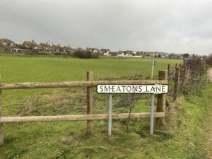
John Smeaton was an experienced engineer with a good record of building harbours, bridges, canals and lighthouses. He is sometimes called the father of civil engineering and was involved in the production of Portland cement. He became involved in the construction of Ramsgate and St. Austell harbours. His proposals were never fully carried out, but the harbour was opened in June 1787. After all those years of work, it was forced to close on November 6 of the same year because the entrance had been blocked by shingle. Harbour Field recreation ground at Winchelsea Beach takes its name from that ill-fated project.
Image Credits: James Stewart , James Stewart CC .
Wonderful essay. Very interesting, I wonder what it would have looked like. Sadly it all happened before photography.
Thank you for your kind comment Steve. I haven’t been able to find any old prints of the harbour. I suppose it wasn’t in use long enough for anyone to make it worthwhile drawing.