

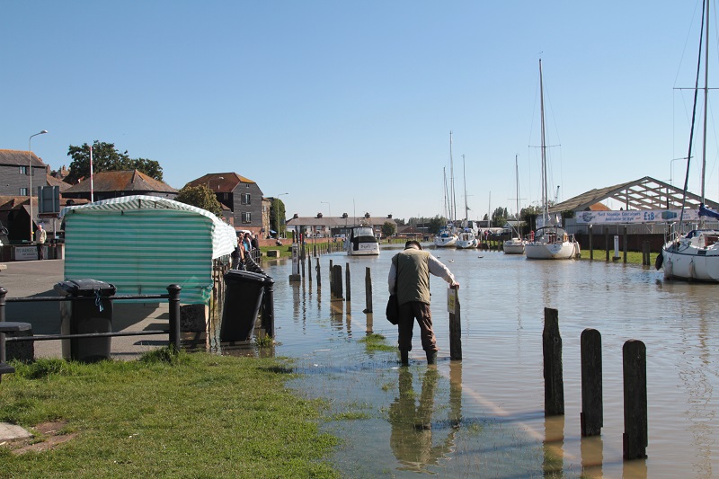
Wednesday September 30. Tide table predicts 4.6 metres. High tide supposed to be at 1.15pm. The water began to retreat at 1.33pm, but by then it had inched under the farmers’market stalls (photo above), and was over ankle level (photo below) on the quayside’s edge. The bad news, however, was over the bridge in Winchelsea Road itself.
A large pool of water had formed, blocking the pathway and extending to the midpoint of the road and round the left hand bend. On a dry, sunny day the water could only have come pushed up from the drains. Cars could not pull out past the pond because it nearly reached out to the middle of the road – and there was traffic coming the other way. Also, the road dipped down on the bend, towards the pavement and most drivers seemed to feel it was too deep to go through other than at a snail’s pace.
Pedestrians had no way through and were crossing the road to the bus stop side where paths go through to the railway line and Gibbet Marsh.
The houses facing the water, and nearest to the bridge over the River Tillingham (where the gates were pushing back the sea) are below road level, down steps, and had sandbags ready in December 2013 when the tide was again very high, and water nearly escaped from the car park and was inches below the top of flood protection walls and bunds.
The distance of those houses from disaster on Wednesday was half the width of the road, and in the car park where the farmers’ market is staged on Wednesdays, the distance was a gentle slope up to the flood gates at the car park entrance.
In February, March and August we had tides of 4.4 metres and for three mornings at the end of October they will again be 4.4 metres. Millions are being spent now on sea defences near Camber and the Dungeness nuclear power station but work on the river defences on the east bank of the Rother will not be completed for around another six years.
In the meantime, any new developments along the Winchelsea Road are limited and development East of the Rother hangs on the new defences being completed. The Environment Agency says “we will work with developers and local authorities to secure the betterment of Rye . . . as well as promoting development that is safe and takes into account the risk of flooding”.
The agency also says it works on the basis of a 5% risk of floods up to 2115, but that is after the defences have been built East of the Rother and takes into account existing defences – such as those around Strand Quay. Those who have homes or premises around Strand Quay, and particularly some in Winchelsea Road (around Wednesday lunchtime), but also anybody who relies on the existing defences, must have cause to wonder about the agency’s existing predictions and strategies.
A 5% risk in a hundred years of flooding may seem small, but a lot of Rye is below sea level, and only protected by sea gates on the rivers and banks, which may not be high enough. When virtually the whole of the seaward side of the nature reserve was flooded in December 2013 (less than two years ago) only the tops of the windows and the roofs of the bird hides could be seen, and the impact on Rye might be just as great. Living on the edge of a potential disaster is not a comfortable feeling.
Photos: Ray Prewer
Image Credits: John Minter .