

The Environment Agency announced earlier this year that it was reviewing how it managed the vulnerable coastline between Folkestone and Cliff End. This coincided with central government’s pledge to provide financial support for the long-term management of this coastline. The work is designed to protect up to 20,000 homes and businesses in the Romney Marsh area.
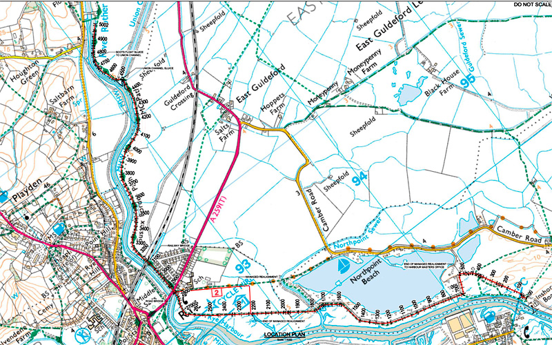
The section of most concern to Rye is the part known as the Eastern Rother Tidal Wall scheme. This will mitigate flood risks on the eastern side of the Rother from Rye Harbour to Scots Float, by raising the earth banks along this stretch.
The agency has just held a public exhibition at the former Freda Gardham School to reveal a project, believed to cost not less than £15 million. Importantly, the agency states that funding is not guaranteed and “we will seek contributions from key beneficiaries to increase the likelihood of priority schemes being eligible for government funding”.
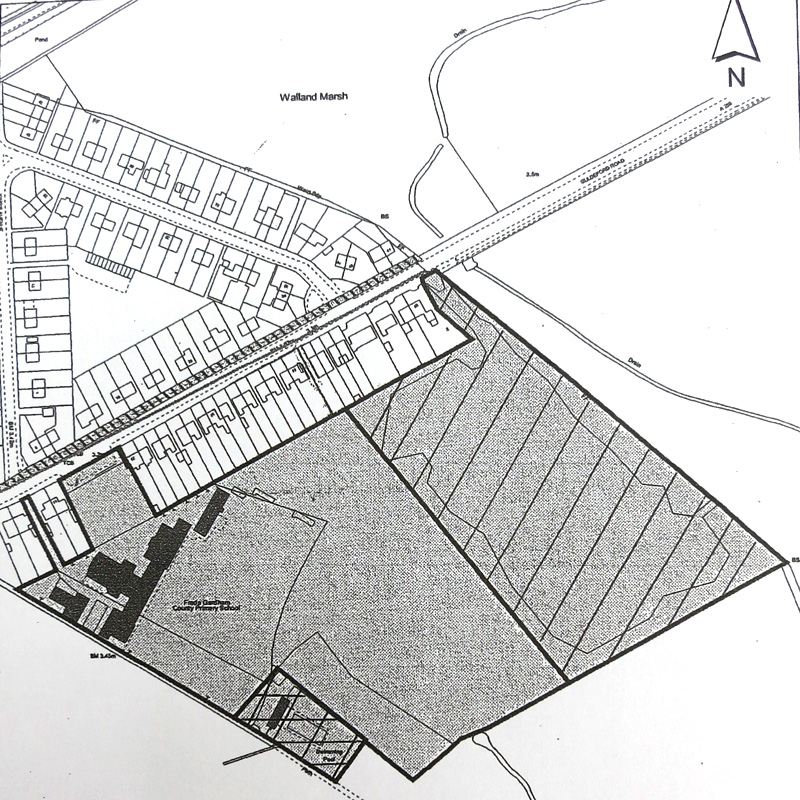
The agency says that the intention is to “hold the line by improving and realigning the earth walls to improve the standard of protection. This would upgrade defences to combat long-term sea-level rise.” The bank to be realigned is a short section of the defences immediately south of the A259 on the east bank (click on map below to enlarge view). The existing curving bank, much loved by dog walkers and others making their way towards Camber, will be realigned east to run straight south along the footpath close to the former Freda Gardham School fence, before bending back towards the Rother.
The realignment is seen as the best way to handle the engineering challenge of countering erosion on the sharp bend below the Monkbretton Bridge, while preventing silt building up against the fishing quay, as well as enhancing the conservation interests of the river habitat.
Over the next three financial years (to 2019) the agency will be preparing a business case. At this stage, it remains unclear when implementation will start, but the Rye Emergency Action Community Team (React) will continue to press on behalf of the community.
This important flood defence scheme will not only increase protection for the dwellings in New Road and Kings Avenue, but is linked to the future disposal and development of the former Freda Gardham School site. It is from this development that the agency hopes to secure contributions to offset some of the costs of the river defence project. Freda Gardham remains in the ownership of East Sussex County Council and, short term, the site is leased mostly to local charity Arrcc.
Those working on the Rye Neighbourhood Plan acknowledge that no disposal of the site will take place until a developer has been found and then only after the flood defence plan is in place. Therefore the situation is rather “chicken and egg” and will require close monitoring.
Photos: Anthony Kimber. React chair Anthony Kimber also vice-chairs Rye’s Neighbourhood Plan steering group
Image Credits: Rye News library .