

To assess what impacts it will have on Rye’s Neighbourhood Plan, Rye News has read the long-awaited Housing White Paper which was released by the government on Tuesday February 7.
Produced after numerous delays, this is the first UK-wide housing white paper in two decades. It laid out how to address Britain’s “housing crisis” of low supply and affordability.
Key priorities within the White Paper are ways to increase housing affordability, both rental and owner occupation, and removing obstacles for councils and developers to build homes.
Under the proposals, local authorities will need to assess future housing needs (currently only 60 per cent of local authorities in the UK set housing targets) and in exchange the council will gain more power to challenge developers that are slow to build on vacant plots. The council will now have the power to revoke planning permission and cut the time delay for work to start from three to two years.
The key question is what does this mean for Rye and its Neighbourhood Plan?
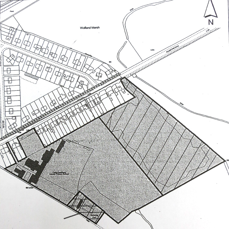
The Rye Neighbourhood Plan, on which the town’s residents will soon be asked to vote, sets out a number of sites for additional housing. There are three sites proposed: Rock Channel, Tilling Green School and Freda Gardham School, with the potential to deliver 110 out of the target of 160 houses for Rye to 2028.
Those of you that know the town well will also know that some of those sites have been earmarked for development for some years.
Dr Anthony Kimber, Vice Chair, and the driving force behind the Rye Neighbourhood Plan, remains confident and said: “We expect the Housing White Paper to be followed by the Neighbourhood Planning Bill. These are both designed to add impetus to house building. Fortunately, the government seems to recognise that Neighbourhood Planners are contributing to the need for more homes, because we have identified sites to meet our target (and more) and are influencing development, therefore we are doing our bit to meet the housing needs of the country.”
In addition to the 160 new homes that Rye will need by 2028, the Neighbourhood Plan also looks at the mix of housing that is needed, including a mix of size and type of housing and a mix of tenure – both home ownership and affordable rental.
While the Neighbourhood Plan identifies the need for more affordable housing, it also seeks to ensure that housing stock and population mix remain balanced, with affordable housing being appropriately integrated into each new development and not isolated in specific blocks.
In the lead up to the Housing White Paper there was a lot of speculation in the media on whether it will encourage development on green field or green belt sites. While the Paper does encourage higher density in areas well served by public transport, it is worth bearing in mind that Rye is ahead of the curve with the Neighbourhood Plan having identified a number of brown field and former industrial sites for housing development.
Over the coming weeks Rye Town Council’s Planning and Townscape Committee will formally ask the Rye Neighbourhood Plan Steering Group to determine the implications of the White Paper on the town plan and make recommendations. Watch this space.
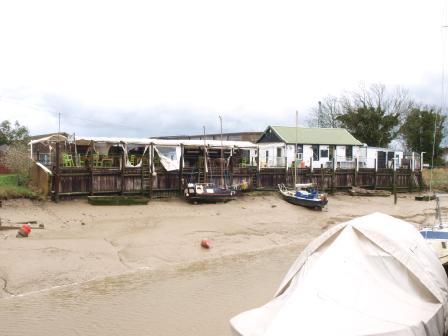
Photos: Rye News Library
Interesting to hear houses already earmarked for rock channel, have been sold,at the ridiculous price of over £600k,these are certainly not the developments, most people do not wish to see in our town
It is interesting to note that Tilling Green is still on the menu for development, when you consider the last developer withdrew because of planning constraints on floodplains. Basically all new housing built on a area that is at risk from flooding; needs to be around three floors high, with no living accommodation on the ground floor, only the upper floors. Unfortunately three story building do not fit into the two story style of buildings found on Tilling Green. It will be interesting to see how the developers cope when they come design houses for the other available floodable sites.
It is worth popping into the excellent public library to read plans for development of Rye and its surroundings dating back 40 years or more including plans for Rye Harbour. These are useful background documents. The RNP excludes Rye Harbour as it is in Icklesham but clearly development there is going to influence planning for Rye itself. One common concern was and is the very dangerous junction of the RH Road with the A259. I do hope that the local plans propose a solution.
All comments on the Rye Neighbourhood Plan are welcome and valuable. They will form the basis of evidence to support the Plan. Flood risk mitigation is a major issue for all new development at river level. (Around 1000 homes and many of the proposed developments are affected) Readers of the Plan will see that we have considered many historical documents back to the 1990s to ensure that we draw on all earlier work
http://Www.ryeneighbourhoodplan.org.uk
And Facebook
I was interested to read the comments made following the publication of the Housing White Paper and its impact on the Rye Neighbourhood Plan. I am curious to know what action, if any, is being made to prompt the owners of the Lower School site to sell the land for housing development when there is so much need for housing? I notice it is not one of the sites mentioned in the list of sites ripe for development in the Rye Neighbourhood Plan and I wonder why?