

A revised strategy for tackling Britain’s coastal erosion is due out in spring 2020 from the government’s Environment Agency (EA). This is supposed to cover the 80 years up to the start of the next century, 2100, following a public consultation in May 2019.
However it may be fighting a losing battle with places like Camber very much at risk from the rising tides.
EA’s current map of flood risks for this area is much more focused on flooding from the rivers, not land behind sea defences, though some of that does reflect river tidal sections below the flood barriers.
Underlying that map though is a long history of land reclamation from the sea, river banks and marshes, and a past history of rivers which were once tidal quite a distance inland (as far as Bodiam for example) until they and some of our former ports simply silted up – or vanished.
Over the centuries Rye Bay has featured a number of shingle and sand banks (some now underwater), and one once housed the harbour of Old Winchelsea before it was swept away centuries ago, only for the new medieval harbour on the seaward side of the heights of today’s new Winchelsea to eventually become silted up in turn.
Indeed the Norman Camber castle, on a shingle spit between Winchelsea and Rye , once overlooked a huge harbour in which the Royal Tudor fleet could shelter because it had a comparatively low draught and did not need a very deep anchorage.
And in those days Camber did not even exist – and may not again in the not very distant future – and the River Rother joined the sea at Romney rather than Rye.
So it becomes very easy to believe that William the Conqueror took the shortest possible route across the Channel in 1066, and rested overnight at sea in the shelter of a shingle bank while waiting for high tide before unloading his army in the sheltered tidal river basin between Winchelsea and Icklesham for the 1066 battle against the Saxons further upstream.
But neither did he land at Pevensey, nor was the actual battle fought at Battle, we are told. Battle was just a useful high point to put up a memorial building with navigation lights, but without archaeological evidence to prove its claim. But that’s another story.
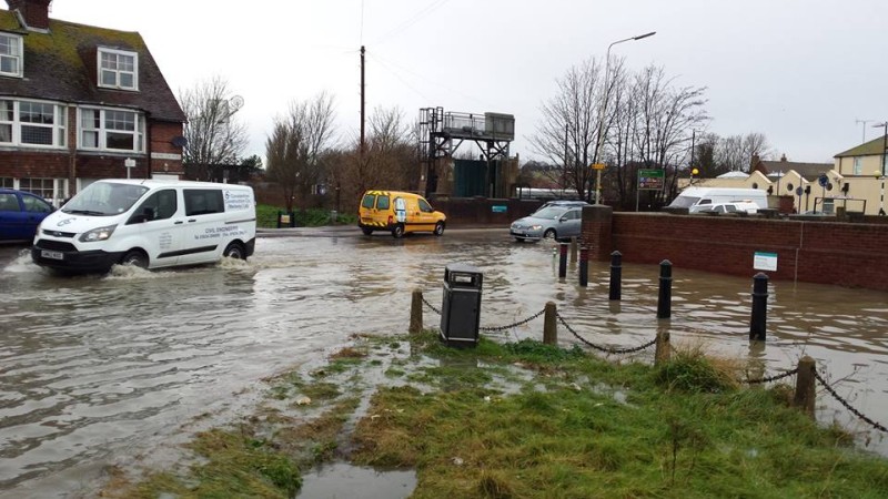
High tides today are already beginning to spill over our defences (see photo) and it may not take much of an increase in tidal levels, as a result of Arctic and Antarctic ice melting, for the Brede to become tidal again, and for the Marsh to return to how it was before the medieval reclamation started.
The EA’s current flood risk maps indicate many of the low-lying areas now along our local rivers, should they become tidal again, and keeping the tide out may be an expensive proposition not only for those immediately on the coast (like Camber, Winchelsea and Pett) but also for those alongside our rivers.
For example if tidal levels keep rising it may be a pointless and expensive exercise to even plan for the (much postponed) Eastern Rother flood defences or even consider improving the existing defences on the Western banks.
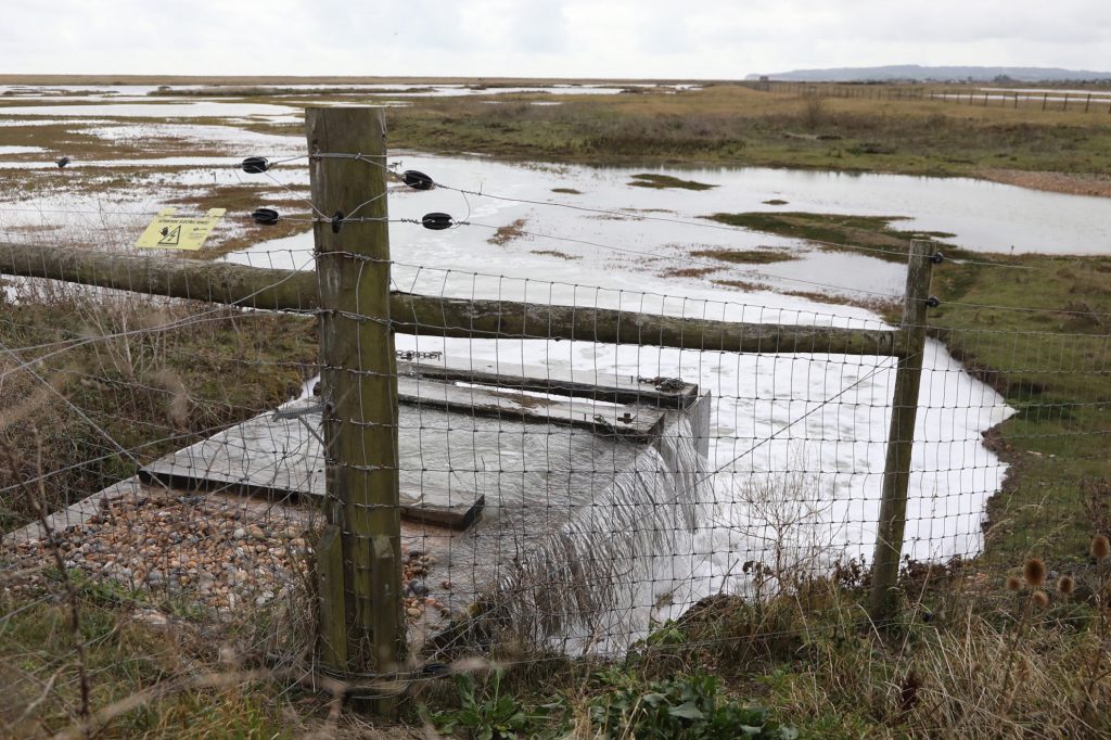
EA strategy to now has included “soak-offs” of suitable land (such as the Rye Harbour Nature Reserve) to painlessly remove the very high waters of some incoming tides (on at least two occasions since I came to Rye in 2012).
But are we really going to play “King Canute” in the face of the rising waters ? Many Pacific islanders were making the point at a pre-Christmas global climate change conference that it is already too late for them.
Satellite photos from the international space station show that we live on a globe (not a flat Earth) and that water flows between our inter-connected oceans.
Melting ice packs and glaciers (whether in the Arctic or up in the Himalayas) will have consequences therefore for every country with coastlines, and coastal towns or villages, such as Camber or Fairlight and the list goes on to include London sheltering behind an increasingly outdated Thames Barrier.
Image Credits: Owen Kemp , Rye News library , Kt Bruce .
One has to smile at Charles Harknesses report and views, on the headliner, Heading under water, as for the high tided spilling over the defences at the Strand Quay Charles,i have seen know evidence of that yet, else the majority of Rye would be flooded, yes there is a problem of ponding,and its a disgrace that this issue has not been resolved. As for the planned cover for the next 80 years,by saying it may be pointless and too expensive too finish off the eastern rother wall, is no comfort for the residents in new road, and kings avenue,who’s lives may be at risk,and insurance hard to get, the inept environment agency, told us by 2019 this wall would be completed,and people are still waiting, and it wouldnt take much with the soft river bank, for a disaster to happen in this part of town.Hopefully if brexit gets done we will not be tied by eu rules stopping the agency dredging our rivers again, and some in that area of the town,can sleep easily again.
Oh dear, another Brexit myth!
Dredging of rivers is not prohibited by any EU rules so the fact that we leave the EU will have no impact on the ability of the EA or other authorities from carrying out necessary dredging. The regulations that I think you are alluding to are The European Water Framework Directive 2000. The objective of the directive is to clean up all ground, surface and coastal waters. I would think that we would all agree that clean water for humans and wildlife is something that we support.
There has been alot of mis-information about the directive including that dredging of rivers has been banned. However, this is not the case. Article 3 of the directive, permits Member States to adopt a lower standard if the changes necessary for achieving good ecological status would have significant adverse effects on “water regulation, flood protection, [and] land drainage”.
In other words, there is a very clear and specific exemption to the stated objective of achieving “good ecological status”, if the Member State judges that the works necessary to achieve that status would have significant adverse effects on flood protection.
However, many rivers have not been dredged not due to the Water Directive but due to Treasury rules on funding. This is unlikely to change post-Brexit. Like many other things that are blamed on the EU.
I would also point out the difference between ‘de-silting’ and ‘dredging’ – dredging changes the contours of a watercourse – deepening and/or widening it; de-silting is a process of removing accumulated silt, without affecting the basic profile of the watercourse. The two activities have different regulation regimes. The UK Govt unilaterally made steps to de-regulate ‘desilting’ works indicating that they are not covered by EU Regulation.