The government wants more housing built, and Rother District Council is having to review its housing plans, which in turn may affect Rye and others’ Neighbourhood Plans.
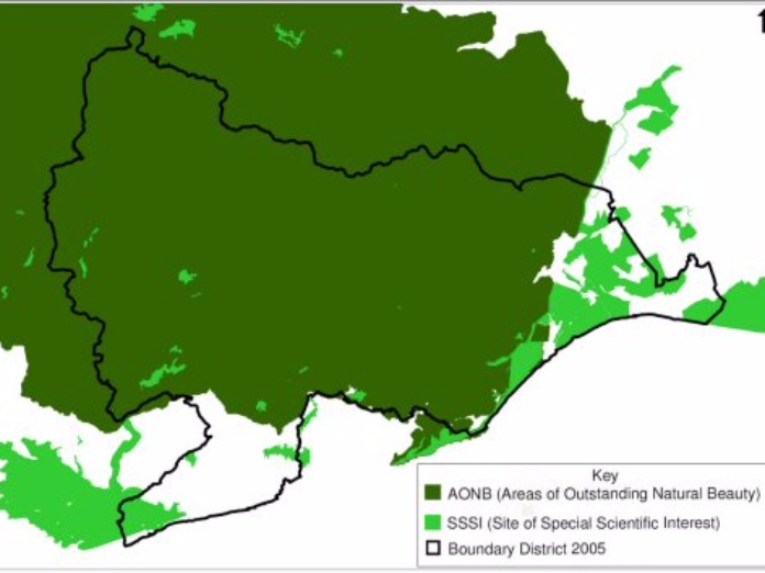
But Neighbourhood Plans reflect existing areas where building is not supposed to be allowed – like the Area of Outstanding Natural Beauty shown above (which stopped a garage planned on the edge of Rye) – or there are practical difficulties too, like areas of flood risk.
However newspaper editors often say that a good picture can tell the whole story and the map above shows how little land Rother can actually allow building on – unless the government tears up the existing rules.
It also shows the only choice for homes might be skyscrapers along the sea shore, but climate change and rising sea levels suggest this is not an option – though Rother might choose to follow Dubai’s example and build on man-made offshore islands, as Monaco is also planning.
But could Rother raise the resources? And there are a lot of SSSIs (Sites of Special Scientific Interest) along the coast blocking that route anyway.
The map clearly shows why Rye did not get a bypass in the ’80s, and probably never will. But Rye might follow the example of some towns and cities and build on top of existing railway lines so, when work has tobe done for high speed trains, non-stop through traffic can go along a “motorway” on top of the railway line.
Image Credits: RDC: Core Strategy Consultation on Strategy Directions 2008 https://rother.oc2.uk/document/153 .


