

On Tuesday afternoon there was a significant landslip of topsoil and vegetation onto Military Road, 200 yards to the east of the Globe Inn. After the recent heavy rainfall, ground water in the Rye Hill escarpment had loosened the surface, causing several tons of debris to slip and block the road. At 7:30 am on Wednesday February 21 the road remained blocked.
There is a history of landslip in this area. Many years ago, Point Hill above the site of this event, had a tennis court, which slipped down towards Military Road. Several smaller landslip events have occurred since, both in the east and west of Rye.
Landslip is a risk which we recorded in the Rye Neighbourhood Plan in parts of Rye where the underlying sandstones, topsoil and vegetation is exposed to water and erosion. If anyone is any doubt about just how much water, then do observe the spring outfalls that occur where the aquifers leak out at the base of the escarpment in locations such as the land to the north of Military Road, west end of Deadman’s Lane, Cadborough Cliff and parts of the Citadel rock wall.
My article on land instability is linked below and I will not repeat the detail here. The issue has been discussed at Rye Planning and Townscape meetings, but this event highlights the need to press Rother District Planners to ensure that they are fully aware of the Rye risks and can handle future development proposals, by imposing strict conditions on any groundwork. My colleague, Dominic Manning has already written to Rother District to suggest that Tree Protection Orders are applied to the risk areas.
Mike Pepler’s youtube video covers the extent of the slip.
It is noticeable that the slip occurred above an area where the base of the escarpment has been excavated and some vegetation removed. It is too soon to link the two events but what is clear is that trees, shrubs and plants should not be removed from areas where there is risk of slip as the roots help to bind the surface soil.
Climate change indicates that we can expect more extreme and prolonged rainfall as there are changes to the Jetstream. Landslip risks are likely to increase in the future.
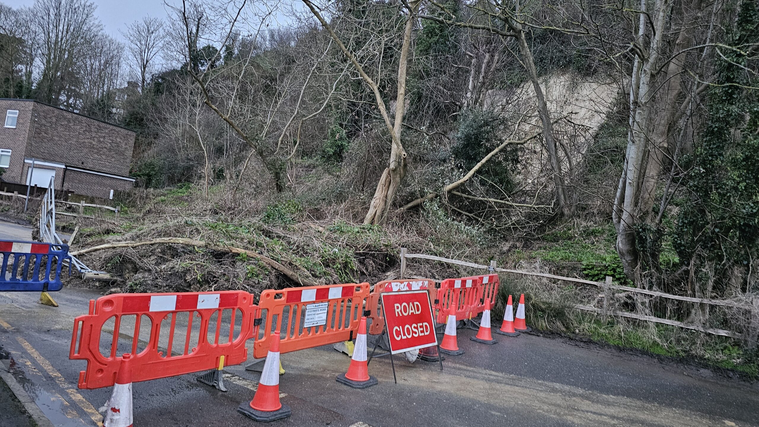
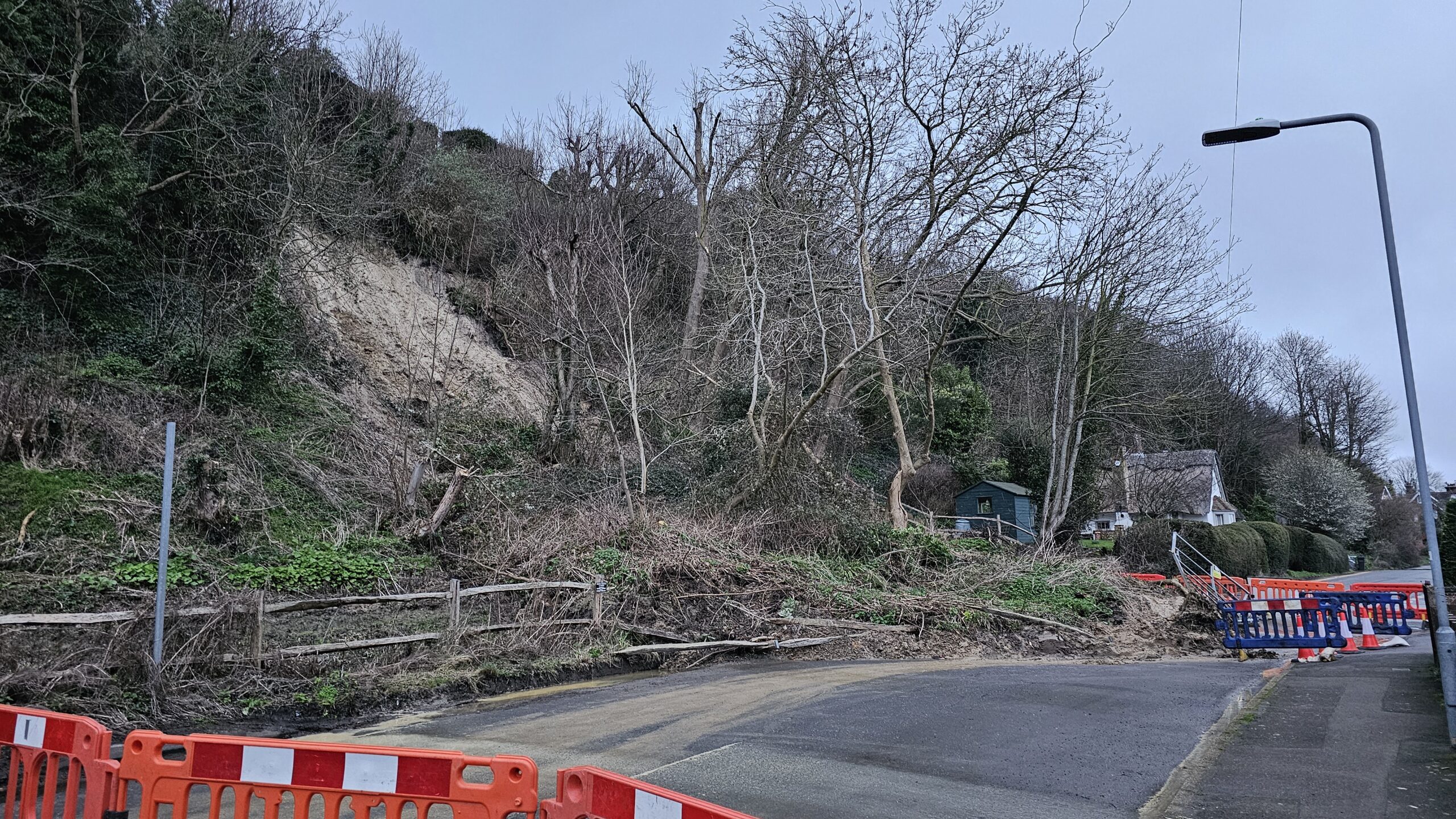
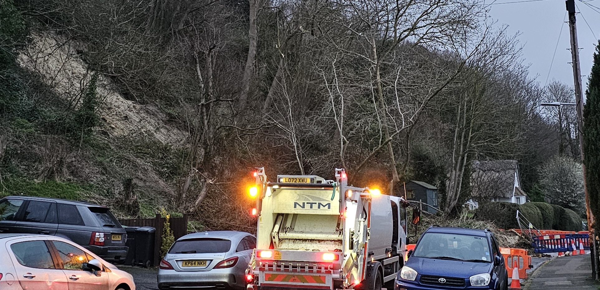
Image Credits: Anthony Kimber .
Thank you for that – interesting reading plus totally agree that tree preservation orders should be in place along the cliff face of Military road. Also feel that any excavation works need some form of licence so that works are controlled to protect the cliff face.
There is an extremely helpful paper on the geology of maritime Kent. In particular there is a very helpful discussion of the landslips that occur in Rye and all along the Kent coast. The paper is by Chris Young and is called ‘Kent’s Changing Coastal Landscape; A View across Space and Time’ and is printed in a 2021 book called ‘Maritime Kent Through the Ages’, printed by the Boydell Press on behalf of the Kent Archaeological Society and Canterbury Christ Church University.
The geology of Rye and district is virtually identical to that found all along the Kent coast and the understanding of the basic processes underlying these landslips is extremely useful in working out strategically what can be done to mitigate the effects.
Coincidentally the paper also contains an excellent description of the formation of Dungeness and the associated shingle beds.