

At some point in 2017 it is expected that we will be voting in a referendum on the Rye Neighbourhood Plan. We at Rye News thought it timely to return to the last town plan – the Rye Action Plan 2009-2014 – and assess what has been achieved, and more importantly what’s outstanding.
Much has been achieved since the 2009 Plan was published. We have a fantastic new cinema in the form of the two-screen Kino. A key recommendation was the need to move and extend the library from its then home in Lion Street. While it was sad to lose Woolworths, after it closed, the site offered a much larger space for the library, which flourishes there today.
As part of the consultation exercise a number of Rye residents asked for additional community facilities – and this was fulfilled with the conversion of Tilling Green School to Tilling Green Community Centre.
Then as now, housing was a key issue within the Rye Action Plan 2009-2014. A target of 450 homes was identified, with the majority being delivered on the sites with outstanding planning permission. Three main sites were identified: Rock Channel; Thomas Peacocke lower school; and north of Udimore Road.
Of the three sites, the two “brown field” sites of Rock Channel and Thomas Peacocke still lie undeveloped while the only “green field” site, north of Udimore Road which we know of as Valley Park, is where 160 houses were built. While additional housing was built in those five years, most notably in the Camber White Sands development, with two of the three main sites still undeveloped, one does wonder if the target of 450 new homes was met?
The perennial issue of concern, both then and now, is transport – both the number of cars coming into the citadel and the need for improved rail services between Brighton and Ashford. One of the recommendations made in the Plan was better signage to the plethora of car parks on the edge of town to deter drivers from coming into the centre. As for the train services, regular readers of Rye News will know that last year’s train service to the town was one of the worst on record.
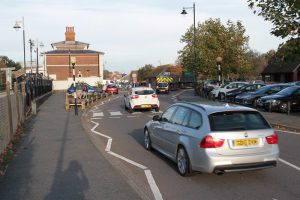
Specific areas were highlighted in the Plan, such as the need to improve the appearance of the “railway corridor” and support regeneration of Crownfields/Station Approach so it is less of a rat run and a better welcome for visitors to the town. This is still outstanding.
Back in 2009, a wide consultation exercise was also undertaken with residents, young and old. One wonders how much has changed. The consultation revealed 80 per cent of residents go outside Rye to buy food and clothing and 72 per cent felt Rye could sustain a second supermarket.
Then as now, the Plan outlined the importance of tourism stating that “the local economy is largely dependent on the visitor to the town; tourism blossomed in the 1960s making it the town’s key industry”. A staggering 94 per cent of residents surveyed thought “tourism was important for the well-being of the town”. In light of this, in the coming weeks we will be taking a closer look at the visitor economy and analysing where tourists come from and how much they spend while visiting the town.
It’s worth pointing out that each plan was developed under a different legal framework. The current draft Rye Neighbourhood Plan is the result of the 2011 Localism Act which devolved decision making powers to local communities. The result is a comprehensive document of 148 pages covering a broad range of issues from flooding to business support. The consultation process has acted as an important way to engage residents on how you would like the town to develop. Rye News is sure to keep you updated as the vote approaches but in the meantime you can read the latest draft here.
Photos: Rye News library
Image Credits: J. Minter .