

The Environment Agency’s recent planning application to improve existing flood defences along the River Rother has met with complaints, most notably from the Ramblers.
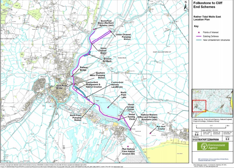
The Agency’s plans, officially called the Folkstone to Cliff End Schemes, aims to reduce flood risk to properties across the Romney Marsh area. This involves work to three flood defences that lie between Rye, to the west, and Hythe, to the east. The three proposed flood defence works are on the east bank of the River Rother; at Lydd Ranges, and at Hythe Ranges.
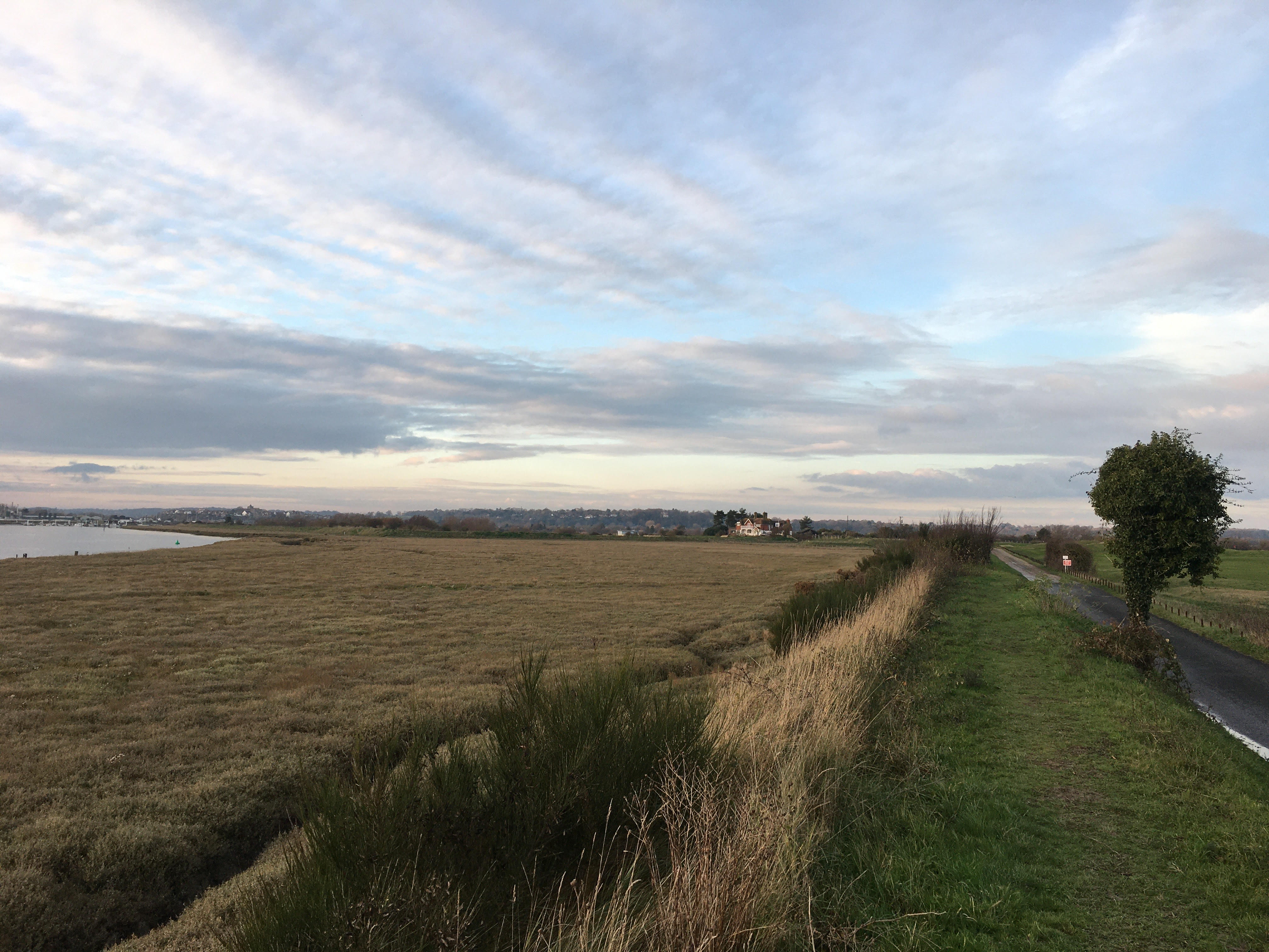
The River Rother flood defence work means that the popular walks along the Rother will be out of bounds for up to two years. In response to the planning application, the Sussex area Ramblers have protested and said, “We recognise the importance of the flood defence work. However, we have serious concerns about the proposed alternative routes being offered to walkers as a replacement.”
The Ramblers undertook a site visit in early December and noted how popular the current paths were with walkers. They then pointed out that it forms part of three popular long distance paths: Sussex Border Path; Royal Military Canal Path, and the Saxon Shore Way.
The Ramblers go on to say that the current path is, “easy to use, in good condition on top of the levee and passable throughout the year. Well signed and simple to navigate, with no road or rail crossings. In contrast, a significant part of the proposed alternative route is hard to use and far less pleasant.”
In the Ramblers’ submission to Rother District Council (RDC), the local planning authority, they list a catalogue of issues with the Environment Agency’s proposed plans, from hazardous crossings to impassable fields, inadequate signage to broken stiles. Their damning conclusion said, “The three long distance paths are very popular and used throughout the year, and bring welcome custom to Rye and the surrounding area. One of the effects of the pandemic has been to greatly increase the popularity of walking, and government policy encourages this. So replacing a very good path with a hazardous, ill-maintained hotch potch for up to two years should not be considered.”
Camberfield realignment
Part of the Environment Agency’s proposals is to reroute the flood defences that run along the River Rother south of Monk Bretton Bridge and through Camberfield, once the site of Rye’s rubbish dump. The current flood embankment along the River Rother at Camberfield is a Right of Way and is popular with walkers and seal spotters alike. The Agency’s proposal is to remove the current embankment and move it 80m inland and allow the “creation of new inter-tidal habitat” between it and the river.
The Environment Agency will reinstate the public Right of Way along the new embankment and provide a new access ramp at its start near Monk Bretton Bridge but there are no plans to continue the public Right of Way to Camber Sands via the raised flood defences that run alongside Rye Golf Club.
While there are two public Rights of Way that go right across the golf course the path most commonly used by walkers, which runs parallel to the River Rother and along the old tramway, is a “permissive path” and the golf club could well remove that permission if it so chooses. To add to the confusion, the current Right of Way that would avoid the golf course altogether has been allowed to deteriorate over the years so that it is now impassable and has retreated back into the salt marsh which contains deep gullies.
Rye Town Council recently discussed ESCC’s Walking and Cycling Strategy and agreed that, “Any future work on the Environment Agency’s flood defence works around Rye provide an opportunity to make improvements to both routes into Rye and connections between those linking outside.”
It remains to be seen if either ESCC or the Environment Agency will heed the Town Council’s request so, as it stands, in the future walkers to Camber Sands could be in the odd position of being denied public access to walk along the top of flood defence embankments that were paid for by the public purse.
Rye Creative Centre
The new flood defences will, in turn, protect residents of Kings Avenue from future flooding. It will also open up the site of the Rye Creative Centre for housing development.
As previously covered in Rye News the management of the Rye Creative Centre was transferred to Martello Developments Ltd in 2019 following the liquidation of ARRCC, the head tenant who managed the site, in 2018.
Keith Glazier, leader of East Sussex County Council (ESCC) and Rye’s representative on the Council, trumpeted the deal at the time saying, “It’s excellent news that we’ve managed to secure the future of Rye Creative Centre for the artists who work there and for the whole community. It’s a valuable part of cultural life in this part of the world and I’m looking forward to seeing it continue to flourish under this new arrangement.”
The deal also included an option for Martello Developments Ltd to take over the freehold of the site from ESCC after the first five years of the lease, but what is not clear is the financial terms of that transfer. Once the new flood defences have been completed and the site is safe from future flooding, it will be worth considerably more in five years’ time than it would have been worth this year when the management was transferred from ESCC to Martello Developments Ltd.
On consulting a local property expert in Rye on the matter they said, “Surely they (ESCC) have a duty of care to the taxpayer to maximise the value of the site and they would need to prove that when the site is sold, that they had tested the market fully and that the final sale price was the best achievable given market conditions at the time.”
If you are interested to learn more about the planned flood defence work or would like to comment on the Environment Agency’s proposals click here.
Image Credits: Allan Thomson , Environment Agency .
Thank you for the helpful article and the map about a scheme that arguably presents a real threat to this community. Whilst understanding the need for secure defences against flooding, I do not understand the need to have long stretches of the existing footpath closed. Can the work not be done in short segments? And, if it is not, are we going to see the entire stretch the subject of slow moving works over a protracted period? I’d suggest that isn’t an acceptable proposition. I walk that path probably twice a week in the summer and encounter a huge number of other residents and visitors to the town enjoying it as I do. And, regarding the riverside stretch from Harbour office to the west of Camber beach, is the golf club really planning to withdraw permission for using that path? I’m struggling to see reasonable grounds for doing so…..
Could the path north of Monkbretton Bridge be re-routed along the west side of the river? The top of the flood defence berm is wide, strong and stable, and has been accepted as a footpath for many years, appearing on maps dating from the 1920s—at present, the landowner has fenced off the access from the Rye Tennis Club end (not sure why), but if this were opened again, one could take a long, safe, off-road walk up to Scots Sluice and there connect with a number of other footpaths.
Improving flood defences is a priority for the whole of the town and naturally it will cause some upheaval in the construction. However I really hope that in the future some sort of path will be reinstated as close as possible to the river providing access from Scots float to camber as it is a wonderful walk as it stands at the moment!